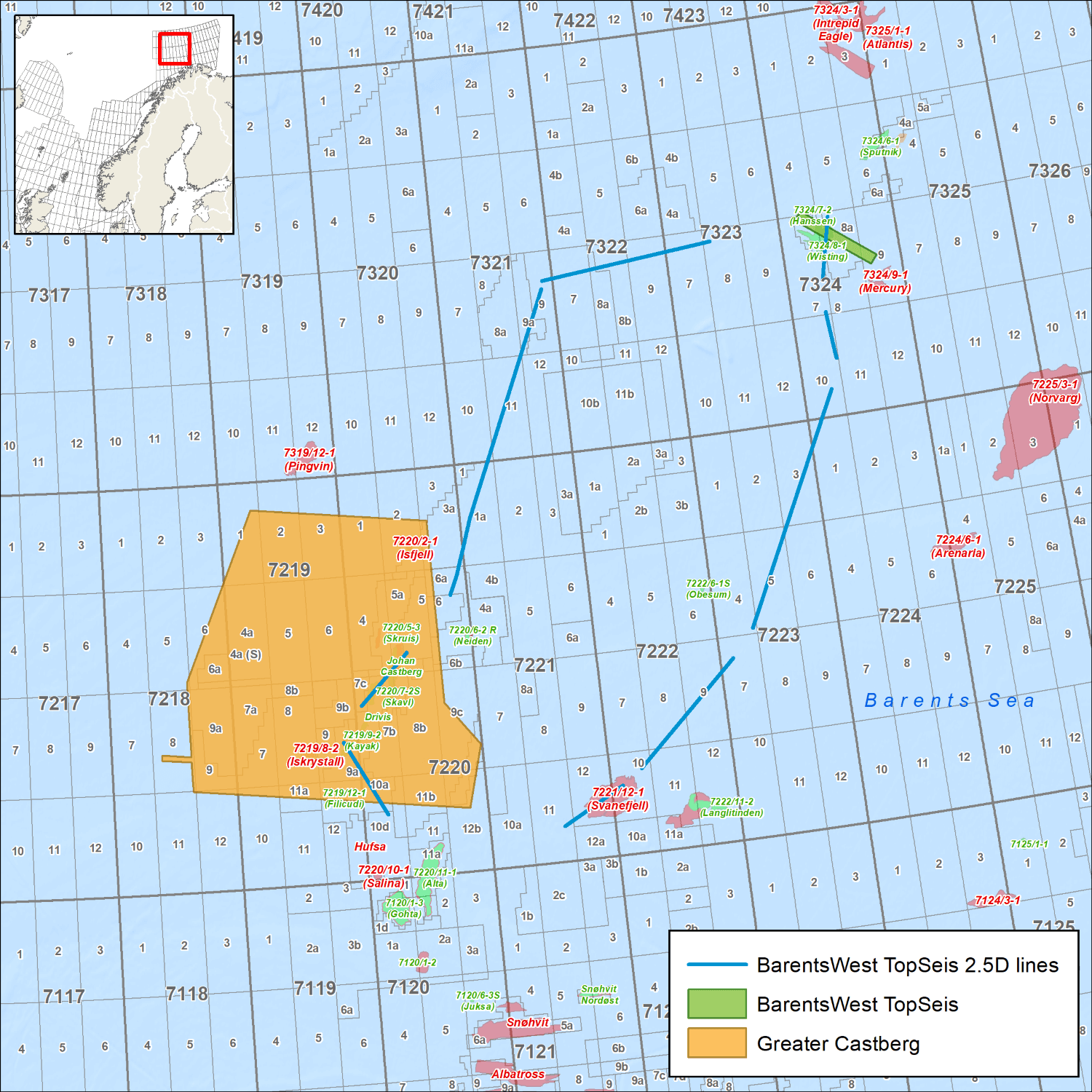
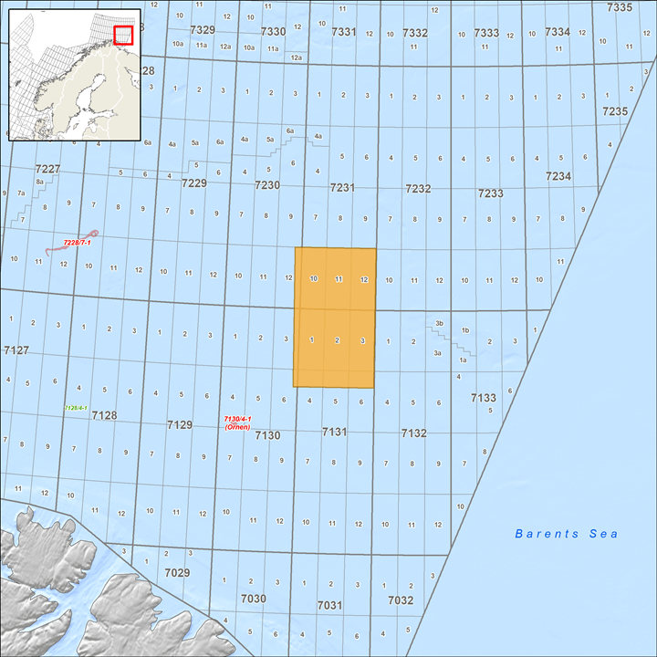
Greater Castberg, Barents Sea
Greater Castberg TopSeis™ data delivers enhanced reservoir imaging in the Barents Sea, with data covering the Johan Castberg field, existing licenses and open acreage. The play types vary in age from Devonian basement to Paleogene. Acquired in 2019 in cooperation with TGS, data has been processed using the latest velocity modeling and imaging technology, including time-lag Q-full-waveform inversion (TL-QFWI). This unique TopSeis solution combines an innovative source-over-spread configuration with CGG’s advanced imaging technology and delivers improved images in the complex Barents Sea environment.
Highlights
- 5,168 sq kilometers of multi-client PSDM data (available now)
- TopSeis configuration with five wide-spread sources deployed above the spread
- Additional source on the streamer vessel to provide long-offset data for FWI and deep imaging
- Superior reservoir imaging with rich near offsets, high trace density and low noise
- Time-lag Q-full-waveform inversion (TL-QFWI)
- Unique, detailed velocity model and well calibration
- Enhanced reservoir characterization with high-quality AVO information
- Verification of AVO compliance at key processing stages
- One-stop data set providing excellent delineation of targets from shallow to intermediate depths
Advanced Imaging with TL-QFWI
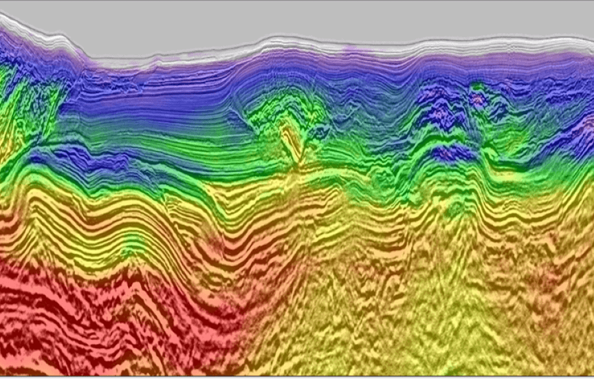
The slider image shows the final Kirchhoff PSDM stack blended with the time-lag Q-FWI velocity model along a seismic line from the Bjørnøyrenna fault complex, passing through three discoveries: Skavl (left), Skrugard (centre left) and Nunatak (right). The Skavl and Skrugard discoveries were made in the early-to-middle Jurassic deposits while the Nunatak reservoir is of Early Cretaceous age.
The TL-QFWI model shows a high level of geological detail, including some of the fluid contacts in the reservoirs.
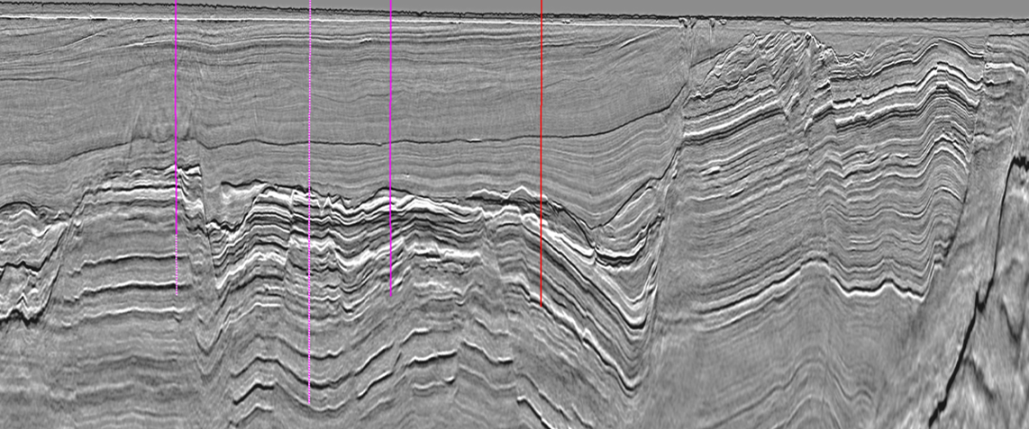
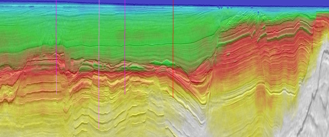
Final Kirchhoff-PSDM stack blended with TL-QFWI velocity model (time domain)
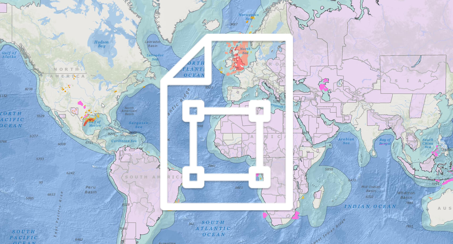
Request a Shapefile
Learn more about our multi-client library coverage. Request a zipped shapefile (.shp) for your region of interest.
Related Technology & Surveys

TopSeis
Obtain high-resolution, shallow-to-intermediate-depth images from innovative source-over-streamer broadband seismic imaging.
Barents Sea
Identify prospects in the northern part of the Finnmark Platform using high-resolution 3D BroadSeis™ multi-client seismic data.
Full-Waveform Inversion
Get highly detailed, data-driven models of subsurface velocity, absorption and reflectivity from full-waveform inversion (FWI).
Explore available multi-client data using our interactive map.
Explore the GeoStore