Gulf of Mexico Seismic Reimaging
Bring new life to legacy Gulf of Mexico seismic data
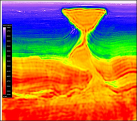
CGG offers the most advanced multi-client seismic data for the Gulf of Mexico, including reprocessing programs that bring additional value to legacy data sets. Multiple azimuth surveys enhance subsurface illumination and improve low-frequency penetration to deliver exceptional subsalt imaging.
Products and Processing Highlights
All reprocessed survey deliverables include a TTI RTM PSDM and a TTI Kirchhoff PSDM with:
- Latest 3D seismic de-ghosting
- Advanced full waveform inversions, including time-lag FWI
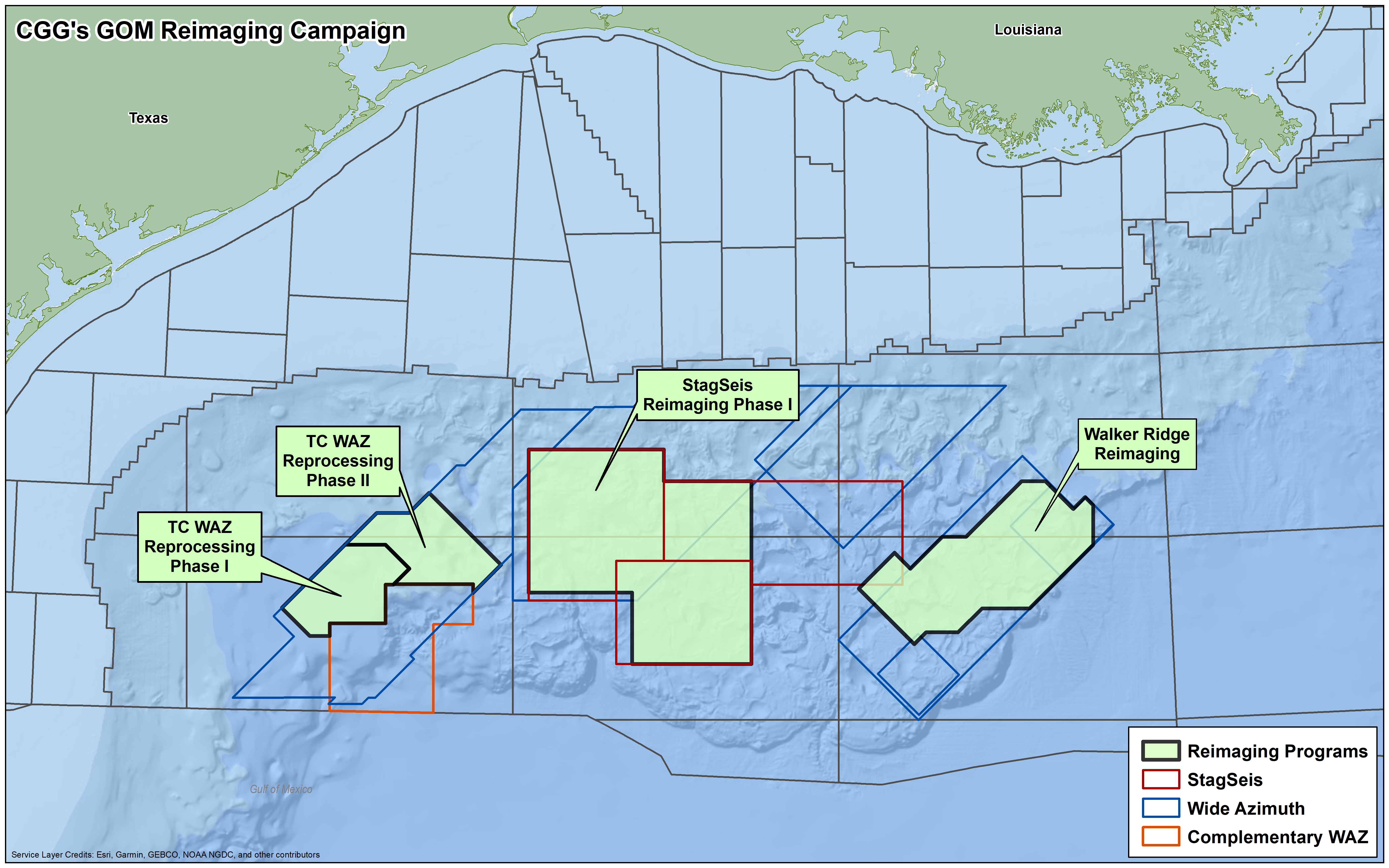

Walker Ridge 3D reimaging
Covering 304 Outer continental shelf (OCS) blocks and totaling 7,086 square kilometers, our Walker Ridge 3D re-imaging program provides new velocity model building driven by time-lag FWI, updated salt geometry, and sediment velocity.

Explore with confidence using Industry-best full waveform inversion
CGG industry-leading FWI imaging better reveals structures in low illumination areas to enable more confident and efficient decision making in finding an producing hydrocarbons in this productive area.

TC WAz Reimaging Phase I and Phase II
Located in the north-central part of Alaminos Canyon, these projects cover approximately 225 blocks adjacent to our AC-CWAz survey, expanding on an area with a recent discovery. The wide-azimuth input data is being reprocessed using state-of-the art workflows, including the latest 3D seismic de-ghosting and time-lag FWI, delivering step-change improvements in definition of complex geological structures within the area.

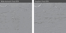
StagSeis Reimaging
This new reimaging project covers approximately 13,900 km2 of CGG’s original StagSeis™ program. The program builds on the StagSeis success story, taking it to the next level by incorporating the latest and most advanced processing techniques including time-lag FWI velocity modeling.

Encontrado and Taurus
The Encontrado survey covers approximately 38,000 km2 of wide-azimuth data over some of the most prospective areas of Perdido. Nine surveys with multiple azimuths were merged together and reprocessed for vast contiguous broadband volume. This survey is complemented by an integrated JumpStart program, designed to enhance understanding of potential prospectivity, including the Trion discovery.
A high-resolution survey, Taurus, was also acquired over the Trion prospect, providing ultra-high-resolution data for geohazard identification. The Taurus survey delivers unprecedented definition of shallow horizons and faults with fine detail in the near surface, as well as vastly improved resolution in the deeper data.
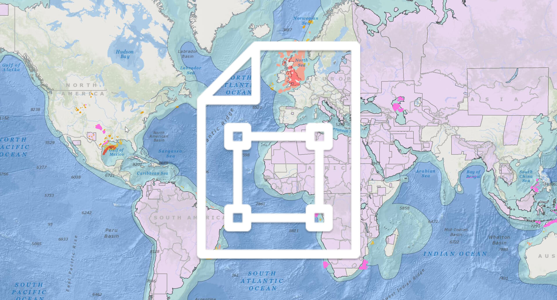
Request a Shapefile
Learn more about our multi-client library coverage. Request a zipped shapefile (.shp) for your region of interest.
Related Technology & Surveys
StagSeis
Reduce risk with this advanced subsalt imaging solution that delivers the best images below complex geologies.
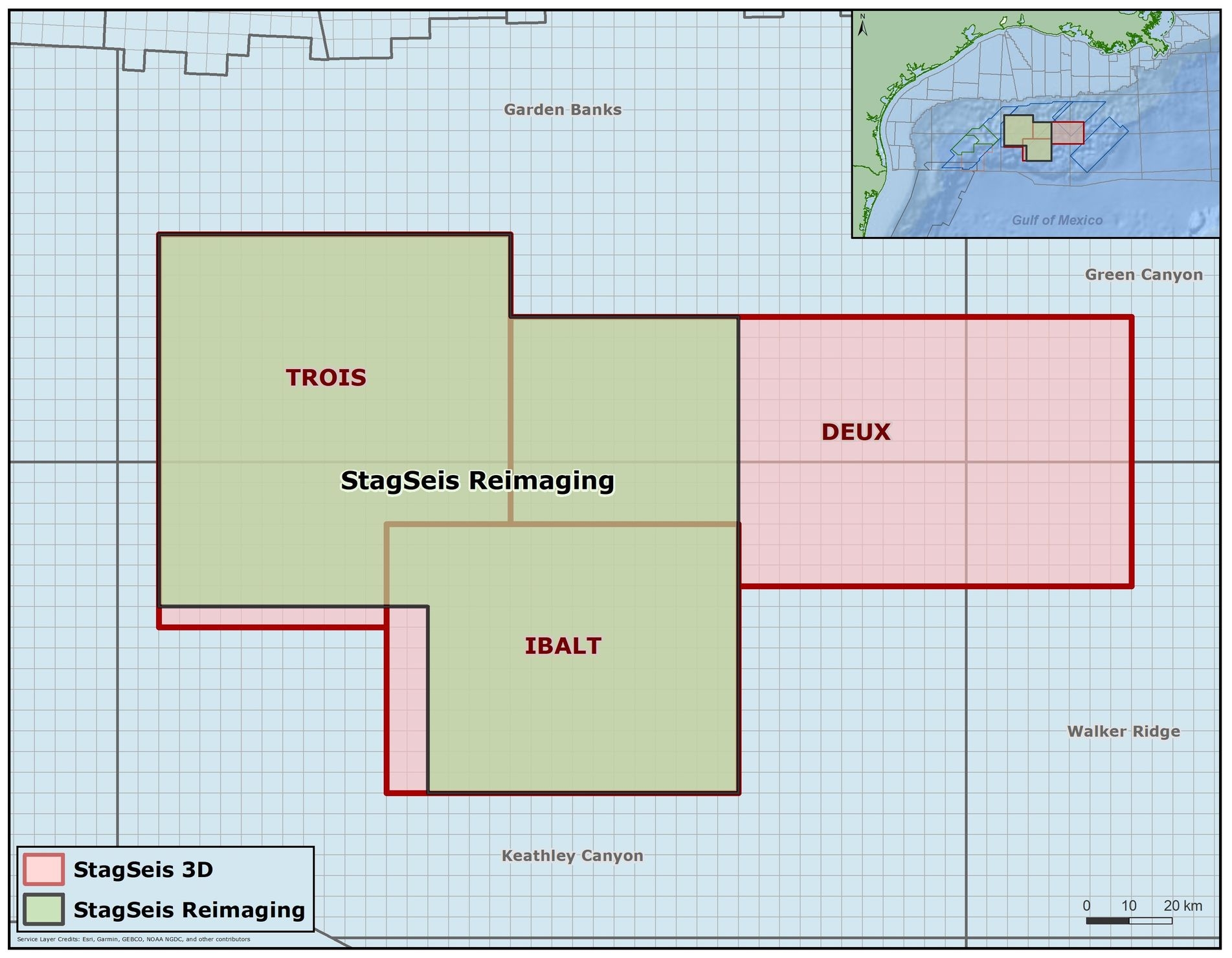
StagSeis Gulf of Mexico
Get outstanding imaging of the subsalt with our Gulf of Mexico StagSeis surveys: IBALT, Deux and Trois.
Mississippi Canyon
Reduce risk with this advanced subsalt imaging solution that delivers the best images below complex geologies.
Explore available multi-client data using our interactive map.
Explore the GeoStore