CGG Leads Research on Monitoring of Ground Hazards Affecting Transport Infrastructure
Paris, France | Mar 15, 2016
CGG GeoConsulting announced that its NPA Satellite Mapping group has been awarded a contract to lead the ‘Live Land’ demonstration project, sponsored by the European Space Agency (ESA) within the “Integrated Applications Program (IAP)”. The aim of Live Land is to design, develop and demonstrate new and innovative services for assessing geological hazards, their impact on UK transport infrastructure and alert geotechnical asset management teams accordingly. This is achieved through the integration of data from Earth Observation satellites and the Global Navigation Satellite System (GNSS).
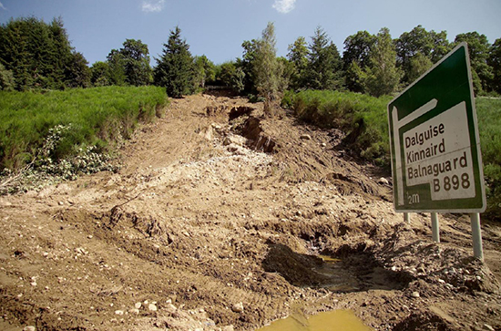
Transport operators across the UK face significant challenges in detecting, monitoring and forecasting landslide and subsidence hazards across their networks. Incidents along or within the vicinity of road and rail corridors resulting from these geohazards can disrupt business and communities, especially in remote locations. As a result, owners and operators of transport infrastructure increasingly need to understand geohazards, to better manage their exposure, mitigate risk and improve their planning and response to incidents when they occur.
The Live Land demonstration project is the follow-on of a previous ESA IAP feasibility study concluded in 2014 and draws on expertise from a team of internationally respected authorities in their respective fields:
- NPA Satellite Mapping (www.cgg.com/npa)
- British Geological Survey (www.bgs.ac.uk)
- Met Office (www.metoffice.gov.uk)
- Nottingham Scientific Ltd. (www.nsl.eu.com) – GNSS experts
NPA Satellite Mapping is a world-leading satellite mapping consultancy that derives geospatial intelligence from satellite imagery. Its mapping solutions are used around the world by a client base ranging from oil and gas operators to transport asset owners to maximize operational insight and minimize risk. NPA Satellite Mapping has considerable experience in leading geohazard research projects for the European Space Agency and European Commission, and, with its expertise in satellite InSAR (surface deformation) mapping, is optimally placed to coordinate and bring to market the unique monitoring solutions that will be developed within the Live Land project.
During an initial 2.5 year period, the Live Land team will together develop a number of innovative solutions that will address the requirements of two prominent Scottish transport operators, Network Rail (Scotland) and Transport Scotland. These services will range from regional geological hazard susceptibility and activity datasets that exploit satellite InSAR (earth observation) measurements, to hazard forecasting models using geological and meteorological data, and the development of cost-effective, multi-sensor devices (GNSS receiver and inertial sensors) for in-situ monitoring. Applied to high-priority sites across Scotland and parts of England, the services will provide new insights into geohazard potential and activity along and in proximity to rail and road assets. Once successfully demonstrated in Scotland and regions of England, Live Land is expected to expand across the UK and continental Europe as the project team engages with other transport operators who could benefit from the new information that will be available on geohazards.
Claire Roberts, Live Land Project Manager, and Remote Sensing Consultant with NPA Satellite Mapping, said: “Live Land will initially play a crucial role in helping to better understand, monitor and forecast geological hazards across the UK’s road and rail networks. The developments targeted in the project are ambitious but necessary given the scale of the issues we want to address. The project team looks forward to working with Network Rail and Transport Scotland and is grateful for their continued support of the project.”