Geoscience
Solutions for complex energy transition, natural resource and environmental challenges.
Subsurface Imaging
Get the most information out of seismic data with our leading technology and internationally recognized expertise.
Geology and Engineering
Reduce natural resource exploration and development risk with expert geological services and analysis, reservoir characterization and engineering expertise.
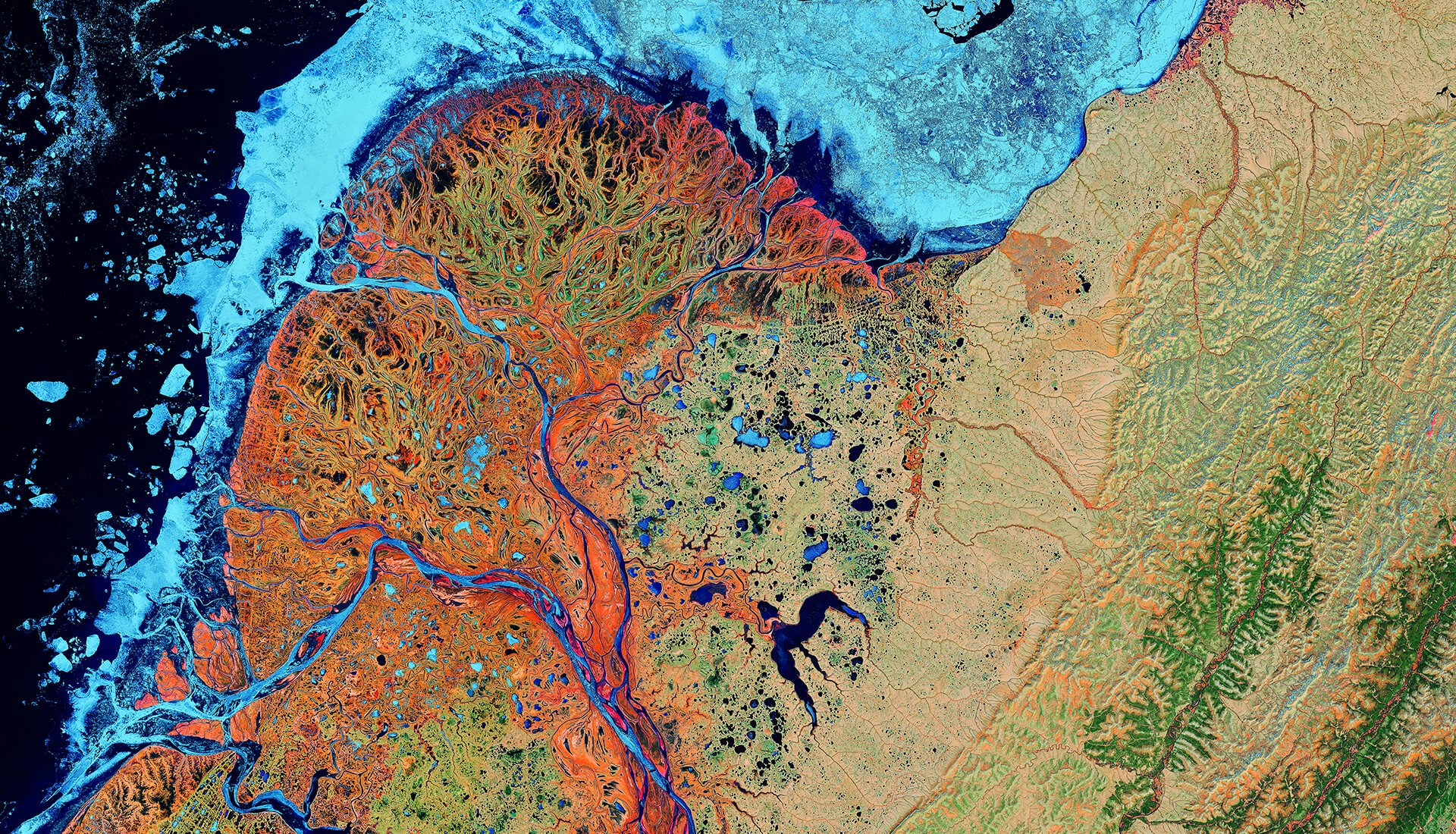
Satellite Mapping
We harness the unique capabilities of Earth observation data to address a diverse range of challenges faced by the Energy, Mining, Engineering, Environment and Defense sectors.
Multiphysics
Imaging expertise and industry-leading software for multi-domain data inversion with experience across natural resource and energy transition applications.
Energy Transition
Our geoscience expertise and data integration capabilities enable our clients to be more efficient, effective and responsible in growing their new energy projects.
Environmental Sciences
Analytics expertise and services to help understand, monitor and manage the human impact on our environment and the transition to sustainable resources.
Resources & News
View AllEnhancing salt model resolution and subsalt imaging with elastic FWI
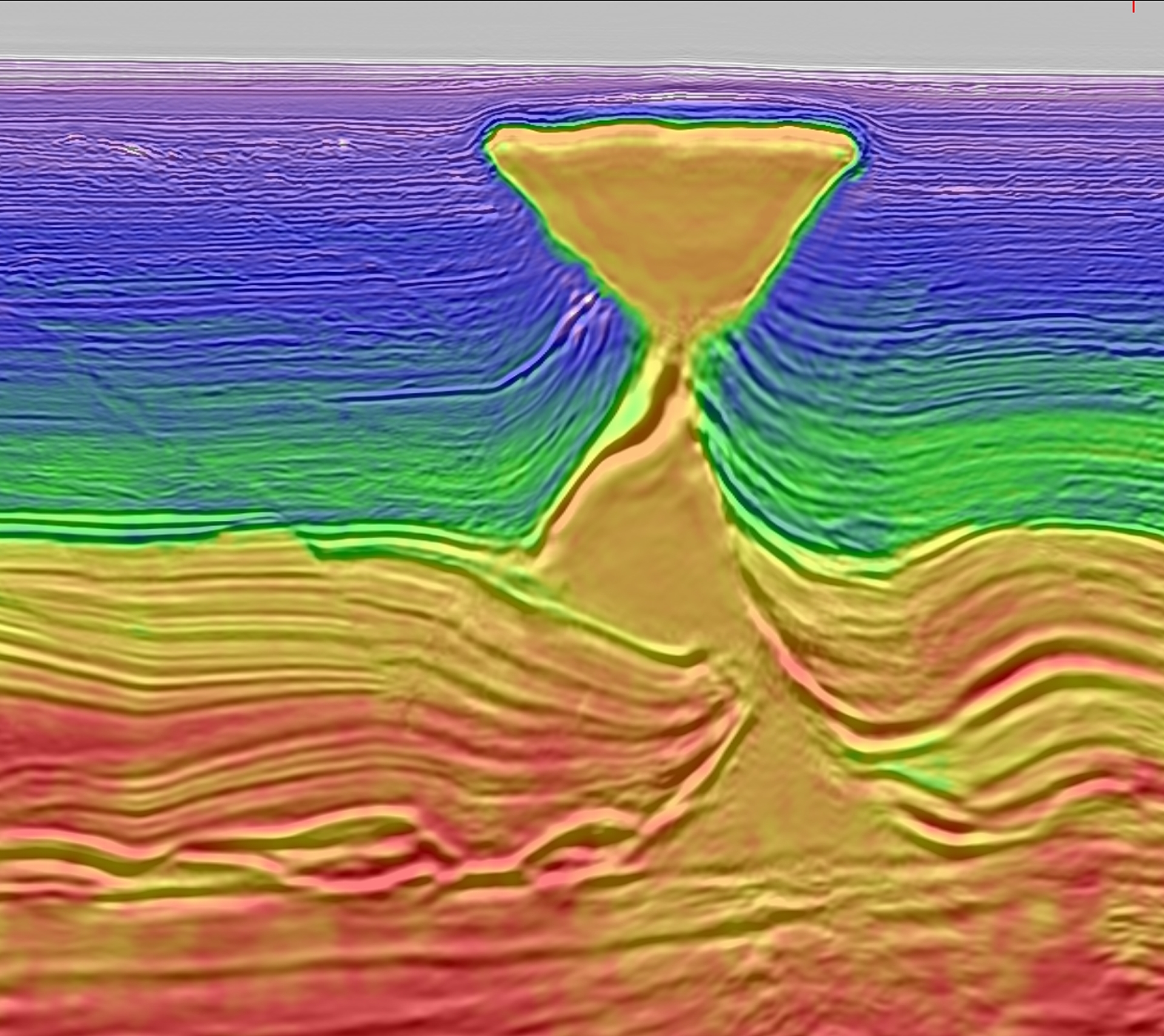
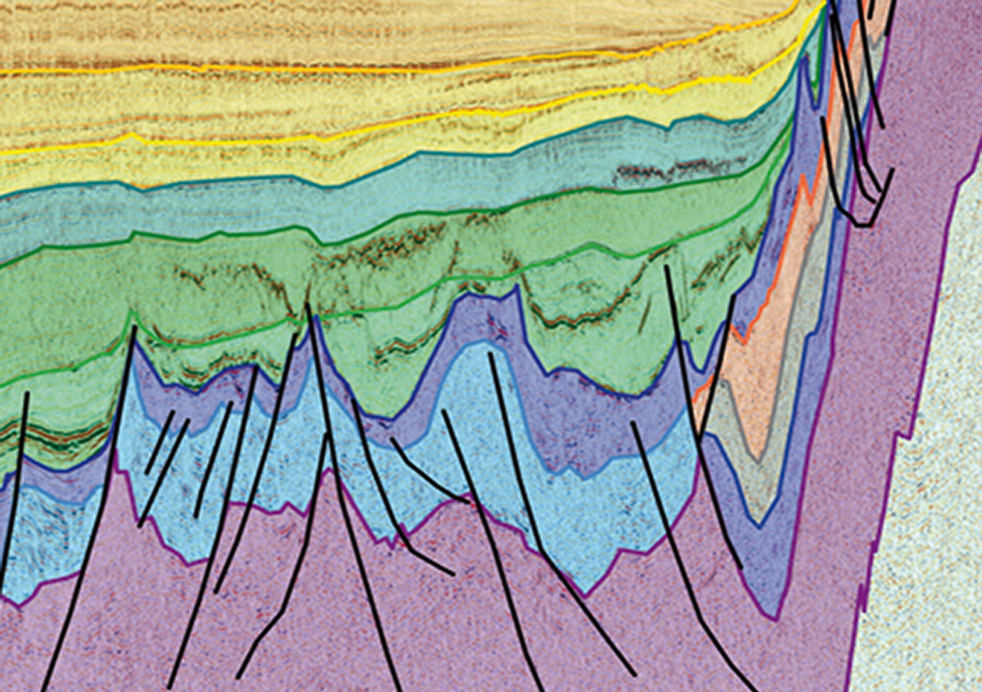
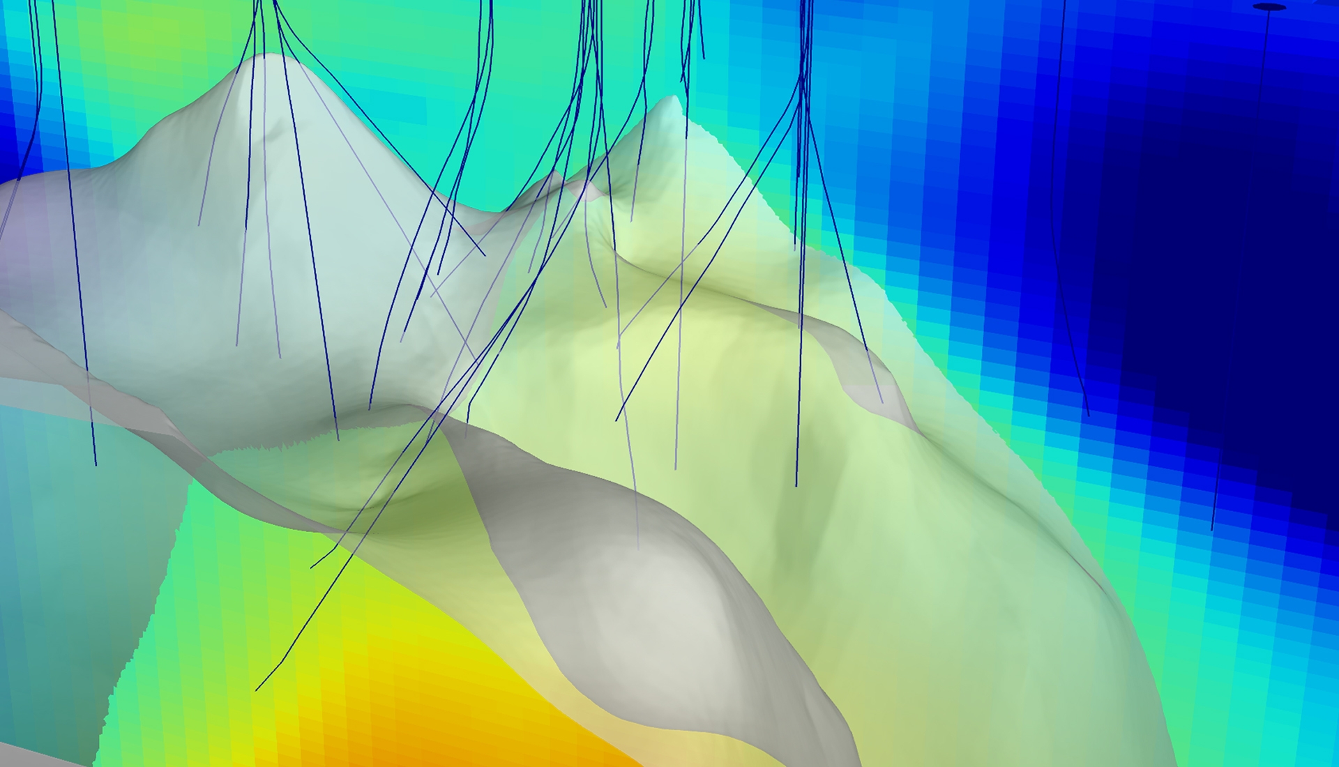
Mar 13, 2023Full-waveform inversion (FWI) has become the centerpiece of velocity model building (VMB) in seismic processing in recent years. It has proven to significantly improve the velocity model, and thus the migration image, for different acquisition types and different geologic settings, including very complex environments such as salt. With the advent of FWI Imaging, which shows remarkable uplifts over conventional imaging approaches because of the inherent least-squares data-fitting process and the utilization of full-wavefield data, FWI further extends its applications from VMB into imaging. However, FWI applications in the industry as of now prevalently employ the acoustic approximation. While the acoustic approximation can sufficiently explain a majority of the recorded seismic data, thus enabling acoustic FWI to derive reasonable velocity models, its limitation manifests itself around strong impedance contrasts where the elastic effect is strong. For example, at the salt-sediment interface, acoustic FWI (A-FWI) almost always leads to apparent salt halos in the resulting velocity models. With synthetic and field data examples, we demonstrate that the salt halo is mainly caused by the large data mismatch between the elastic input data and the acoustic modeled data in acoustic FWI, particularly at middle to long offsets. Therefore, we developed an elastic FWI (E-FWI) algorithm that combines an elastic modeling engine with the time-lag cost function, which we call elastic Time-lag FWI (E-TLFWI). With a more accurate modeling engine, E-TLFWI can significantly reduce the salt halo observed in its acoustic counterpart. Nevertheless, the migration images using the acoustic and elastic FWI velocity models remain similar overall, with some slight improvements around and beneath salt boundaries, particularly near steep salt flanks, as a result of the reduced salt halo. By contrast, FWI Images derived from E-TLFWI show considerable benefits over those from acoustic Time-lag FWI (A-TLFWI), such as improved event focusing, better structural continuity, and higher signal-to-noise ratio (S/N). The sharpened salt boundaries and enhanced quality of the FWI Images justify the value of elastic FWI.
CGG Announces its Q1 Financial Results on Tuesday 14th May 2024, after Market Close
CGG will announce its first quarter financial results on Tuesday 14th May, after market close. ...
CGG's key role in advancing regional business and energy transition objectives
Exploring the Middle East’s energy landscape in an exclusive chat with CGG’s Ramez Refaat ...
Careers at CGG
Whether you are a recent graduate or an experienced professional, find your next opportunity at CGG.

Seismic Imager
Are you a physicist, data scientist, engineer, mathematician or problem-solver? Good, glad we have that in common! Join us in transforming real seismic data into stunning 3D images of the Earth’s subsurface. No experience? Don’t worry, we’ll show you the way.
Show Me Open Roles
Software Developer
Do you treat your code the way you want others’ code to treat you? If so, you are at the right place. We have exciting development work to do globally, including high-performance computing, imaging and reservoir algorithms, and our proprietary seismic imaging software.
Show Me Open Roles
Geoscientist
What would a geoscience company be without geoscientists? Join a diverse team of sedimentologists, stratigraphers, geochemists and structural geologists to tackle our clients’ exploration and environmental challenges from multi-disciplinary data sets.
Show Me Open Roles