Earth Data
Gain a unique perspective with the industry's most technically advanced seismic and digitally transformed geologic data.
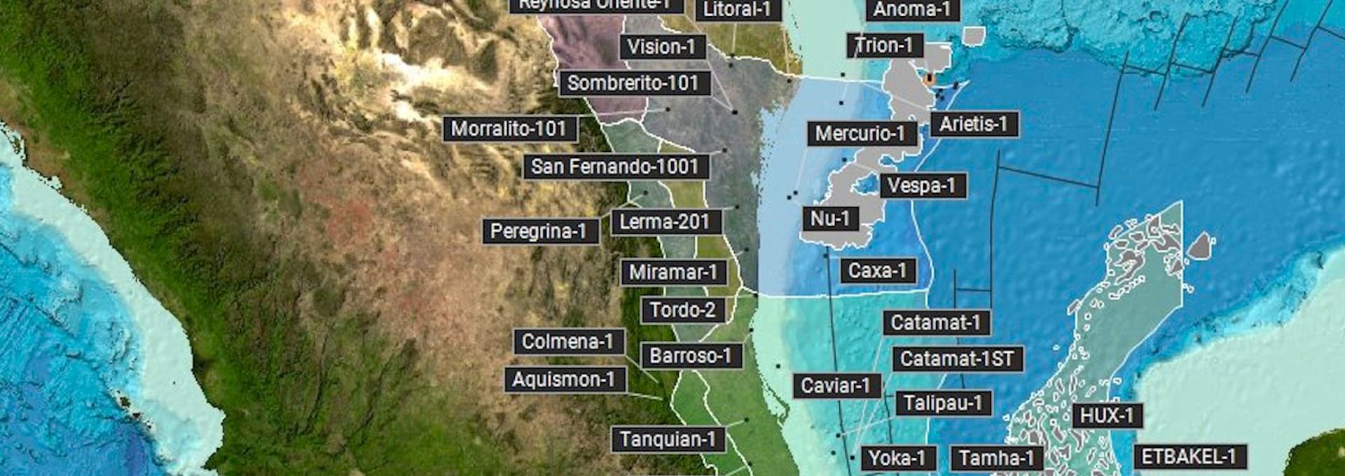
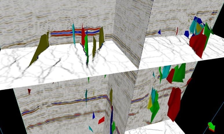
Multi-Client Seismic
Gain new insight and make more informed decisions with the latest, most technologically advanced seismic data in the world’s key locations.
Featured Surveys
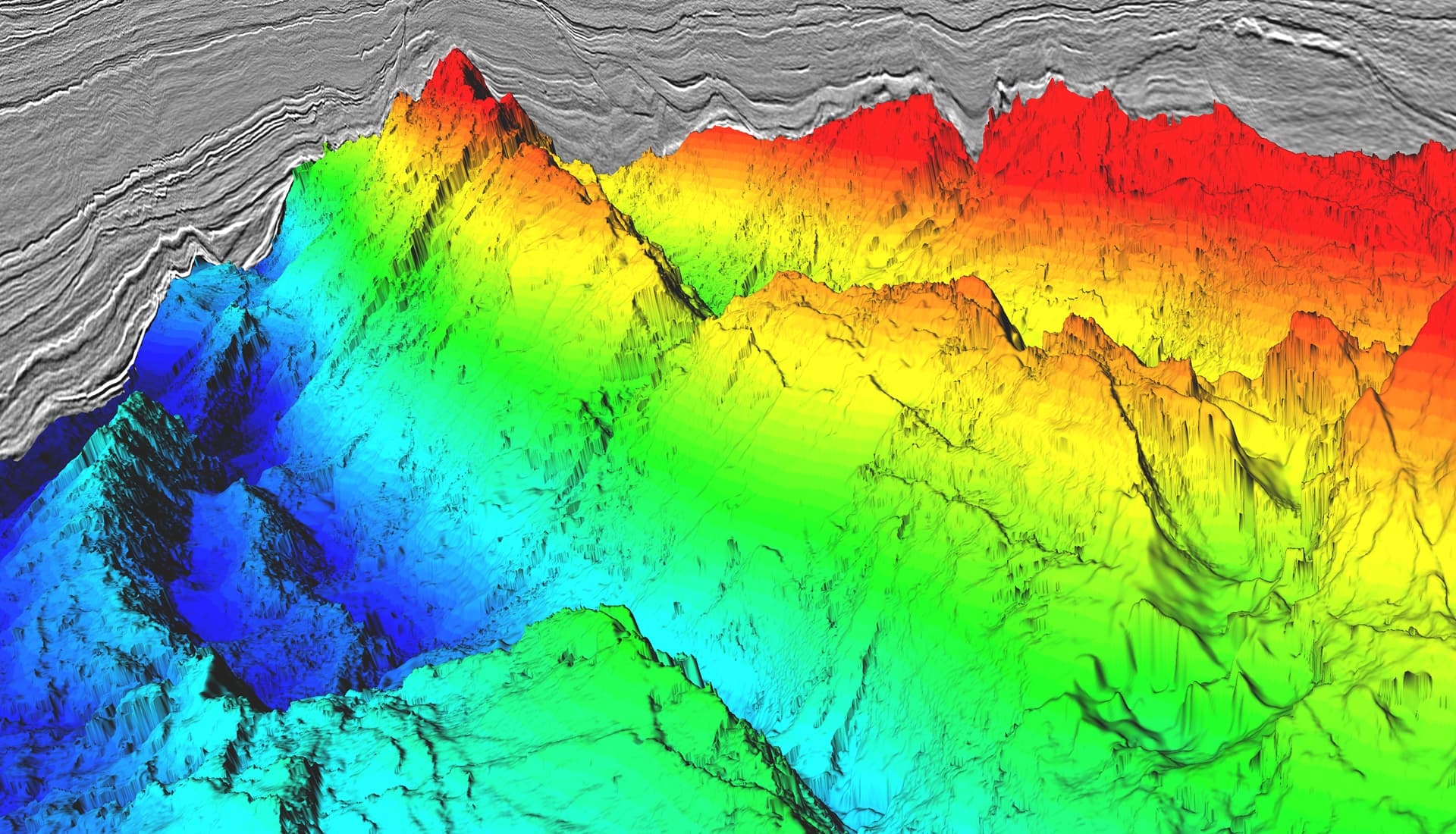
Geologic Data
Enhance subsurface knowledge with analytics-ready geoscience data from our extensive, digitally transformed Earth Data library.
Featured Products
Legacy Data
Reduce exploration risk in frontier basins with a comprehensive portfolio of enhanced legacy data and insightful interpretive products.
Featured Regions
Request a Shapefile
Learn more about our multi-client library coverage. Request a zipped shapefile (.shp) for your region of interest.
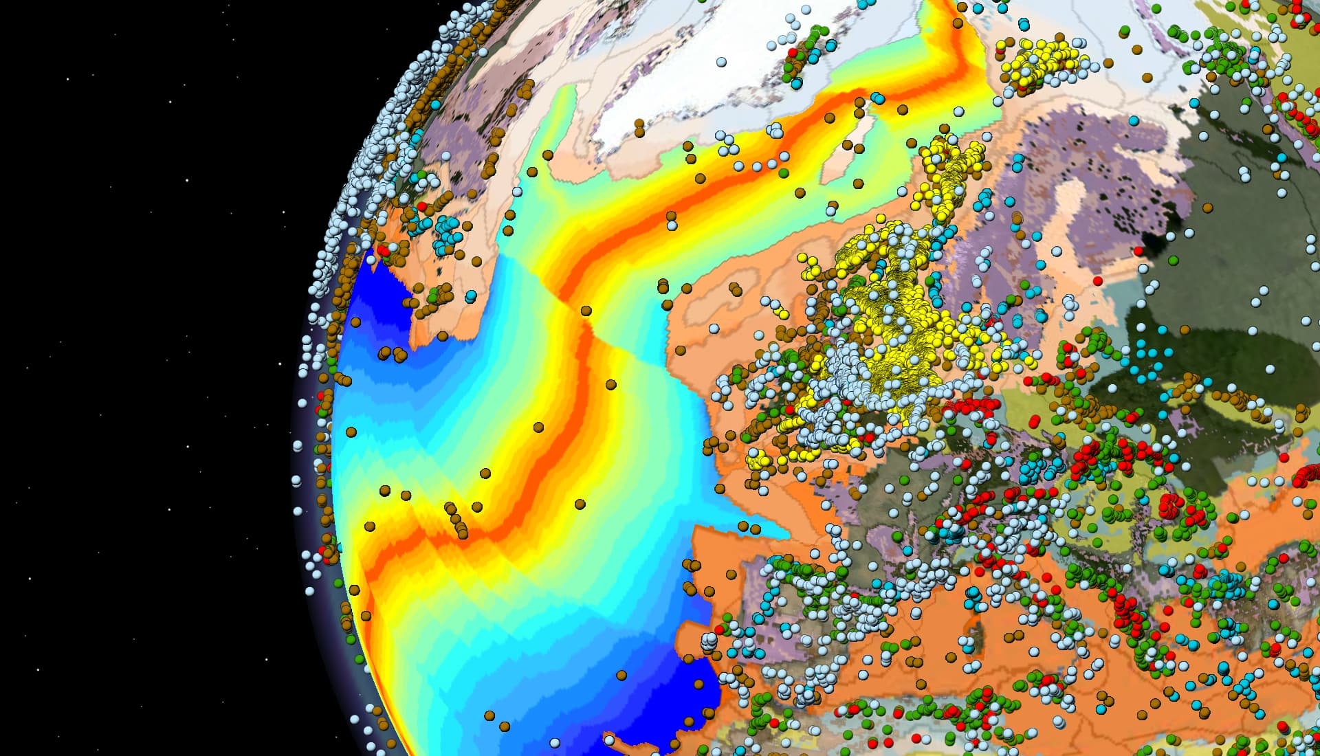
Gravity & Magnetics
Data and interpretations to aid fundamental understanding at basin-to-prospect scales.
Resources & News
View All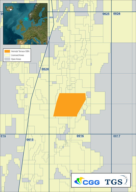
CGG and TGS Announce a Dense OBN survey in Balder and Ringhorne Areas of Norwegian Continental Shelf (NCS)
Paris, France | Feb 9, 2023CGG, a global technology and HPC leader, and TGS, a global provider of energy data and intelligence, have been jointly awarded the acquisition and imaging of a dense ocean bottom node (OBN) multi-client seismic survey in the Balder and Ringhorne areas of the Norwegian Continental Shelf (NCS).
Sercel Announces First Commercial Sale of its New 528 Land Acquisition System
CGG announced today the first major sale by Sercel, its Sensing & Monitoring business line, of its next-generation 528™ cable-based land acquisition system to the Turkish Petroleum International Corporation (TPIC). ...
CGG's key role in advancing regional business and energy transition objectives
Exploring the Middle East’s energy landscape in an exclusive chat with CGG’s Ramez Refaat ...
Careers at CGG
Whether you are a recent graduate or an experienced professional, find your next opportunity at CGG.

GIS Analyst
Become part of our GIS team, the leading independent distributor of commercial satellite imagery. Our experienced remote sensing experts collaborate closely with clients to derive intelligence from imagery across offshore and onshore environments.
Show Me Open Roles
Geoscientist
What would a geoscience company be without geoscientists? Join a diverse team of sedimentologists, stratigraphers, geochemists and structural geologists to tackle our clients’ exploration and environmental challenges from multi-disciplinary data sets.
Show Me Open Roles
Seismic Imager
Are you a physicist, data scientist, engineer, mathematician or problem-solver? Good, glad we have that in common! Join us in transforming real seismic data into stunning 3D images of the Earth’s subsurface. No experience? Don’t worry, we’ll show you the way.
Show Me Open Roles