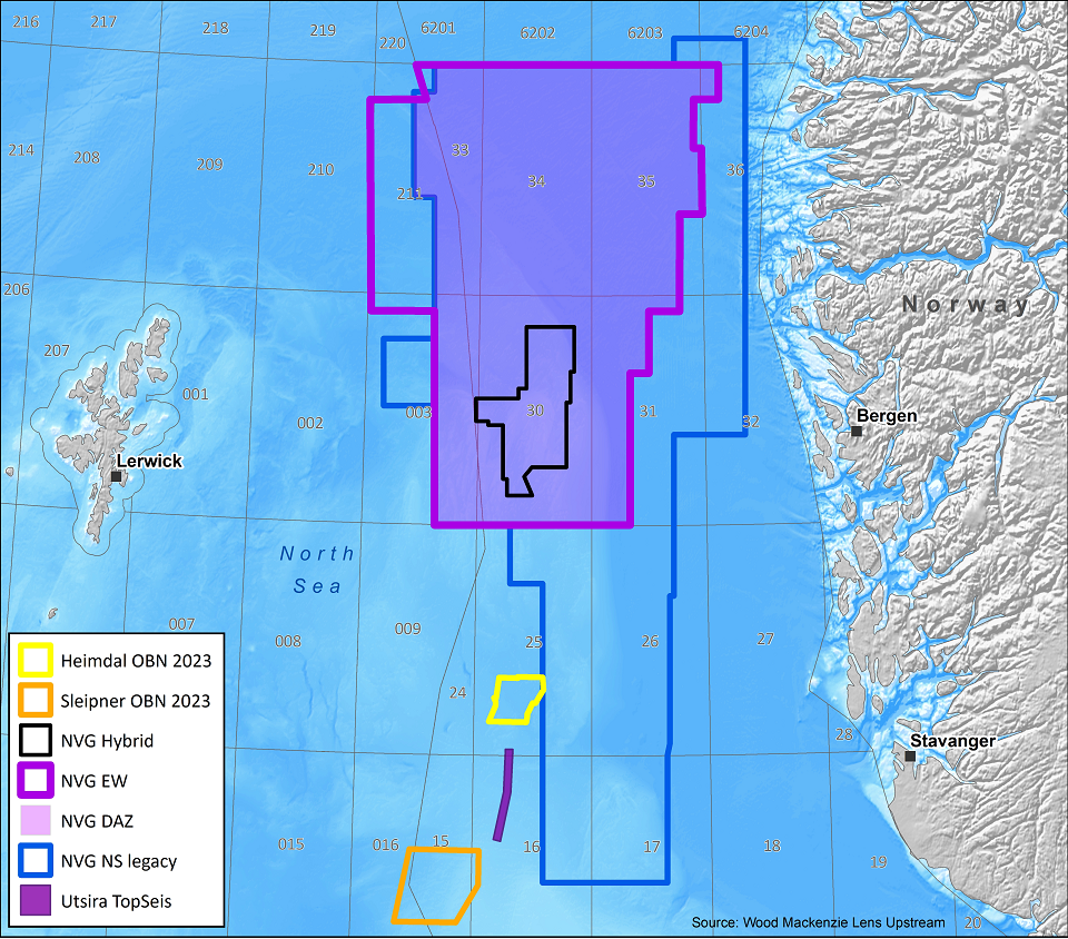
Northern Viking Graben
Mitigate near-field risk in the Northern North Sea with a new dual-azimuth volume
CGG has a consistent regional dataset in the Northern North Sea (Norway and UK sectors) of more than 44,000 km2 high-quality North-South PSDM data. Adding to this extensive data library, CGG has recently acquired more than 28,000 km2 of East-West 3D data to provide a dual-azimuth volume. The latest addition to complement the NVG survey includes new NVG Hybrid data that showcases an innovative approach of optimizing full-waveform inversion (FWI) through sparsely distributed nodes combined with streamer acquisition.
These datasets are readily available to:
- Identify and de-risk near-field exploration targets
- Aid maturation of stranded discoveries towards development
- Enhance the imaging of multi-directional fault patterns
- Provide enhanced resolution to resolve complex reservoir stratigraphy
NVG Dual Azimuth
New East-West acquisition is being combined with a full reprocessing of the underlying NVG North-South data to generate a dual-azimuth seismic data set.
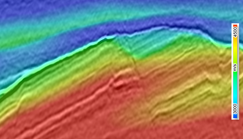
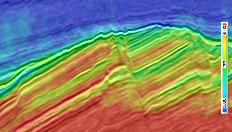
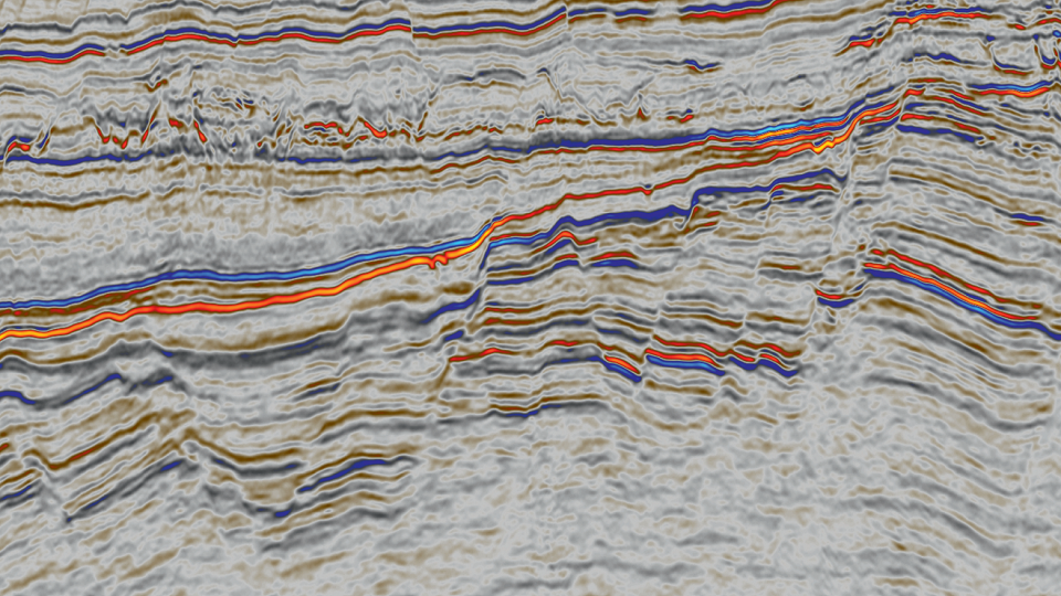
New Northern Viking Graben dual-azimuth velocity model highlights details within Lower Jurassic reservoir intervals
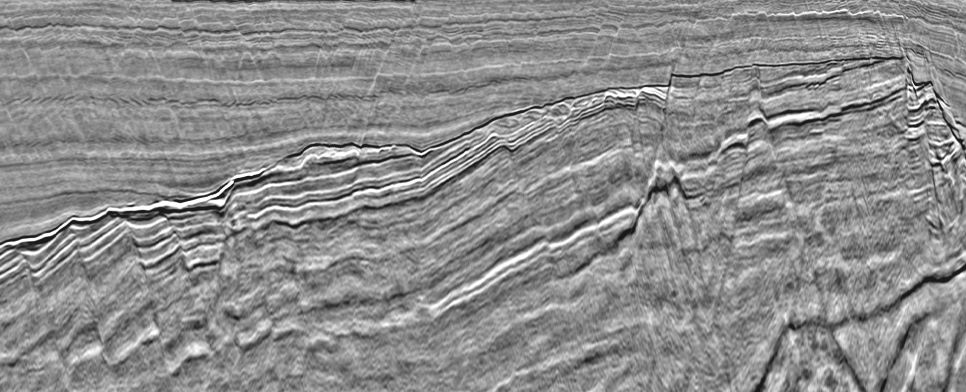
Comparison of 2018 single-azimuth Q-PSDM (before) and 2021 dual-azimuth final (after)
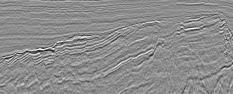
Innovative, hybrid acquisition for greater uplift
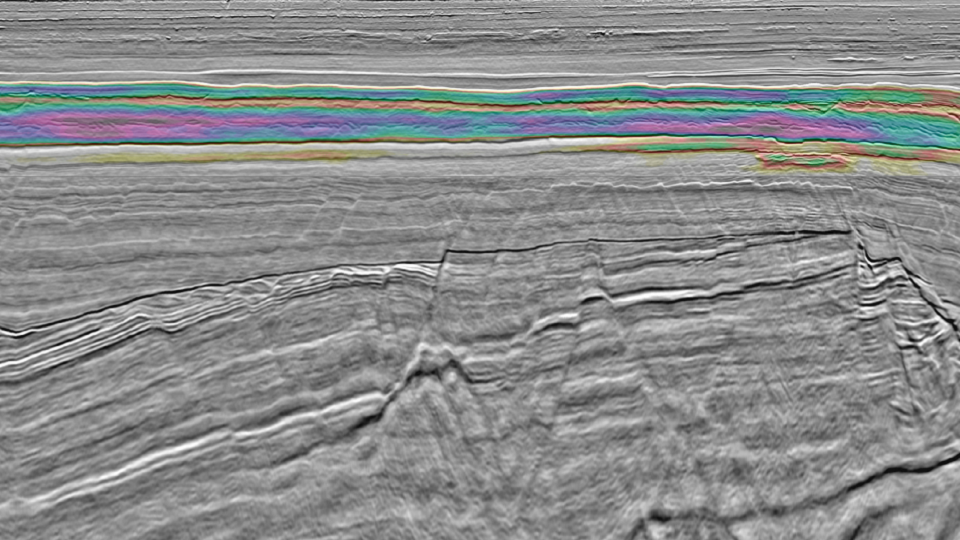
The NVG Hybrid seismic dataset, covering the Oseberg and Martin Linge fields, optimizes full-waveform inversion (FWI) through sparsely distributed nodes in combination with streamer acquisition. By applying time-lag FWI (TLFWI) using offsets up to 60 km, we have greatly improved our velocity modeling and imaging capabilities of deeper and more complex subsurface targets.
Latest technical articles
Northern Viking Graben - Chasing the Upper Jurassic play
GeoExpro | Jaswinder Mann, Anna Rumyantseva, Idar Kjorlaug ©2023 GEO EXPRO PUBLISHING AS | May
Seismic technological advances: new insights to near-field exploration
First Break | Federico Buriola, Jaswinder Mann, Thomas Latter, Idar Kjorlaug, Anna Rumyantseva ©2023 EAGE | May
Northern Viking Graben: a dual-azimuth solution
GeoExpro | Anna Rumyantseva, Jaswinder Mann, Idar Kjørlaug ©2022 GeoPublishing Ltd | April
Request a Shapefile
Learn more about our multi-client library coverage. Request a zipped shapefile (.shp) for your region of interest.
Related Technology & Surveys
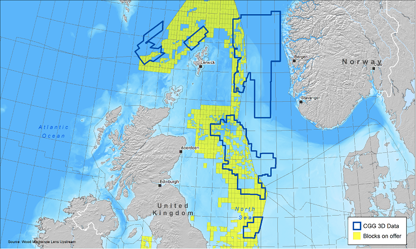
33rd UK Licensing Round
Jump start your North Sea development plans with the most recent and advanced seismic data.
NCS Licensing Rounds
Best-in-class seismic and well data with expertise to support both E&P and CCUS developments on the Norwegian Continental Shelf.
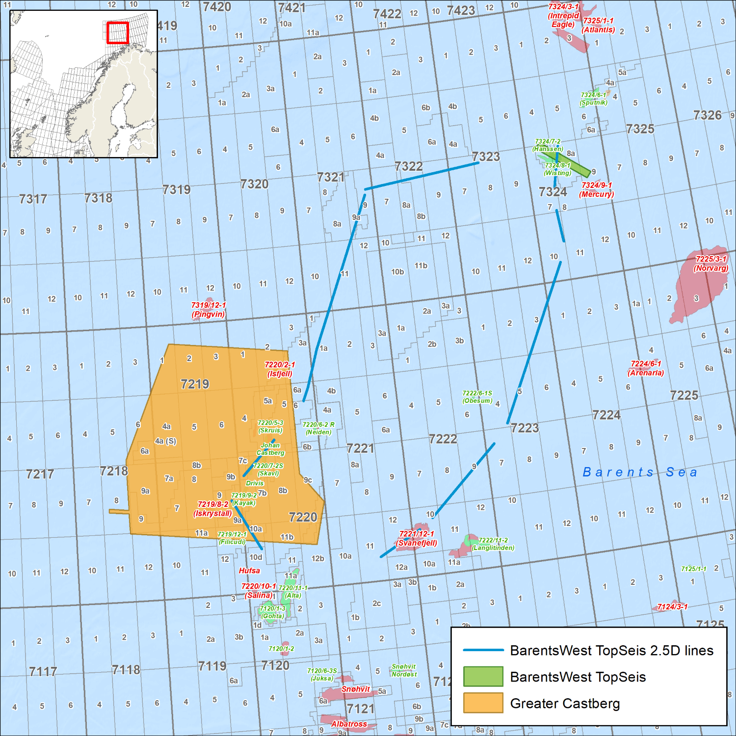
Greater Castberg
Greater Castberg TopSeis™ data delivers enhanced reservoir imaging in the Barents Sea, with data covering the Johan Castberg field, existing licenses and open acreage.
Explore available multi-client data using our interactive map.
Explore the GeoStore